$4.14
Original: $13.81
-70%#238 Broughton-Johnstone Kayaking and Boating Map—
$13.81
$4.14The Story
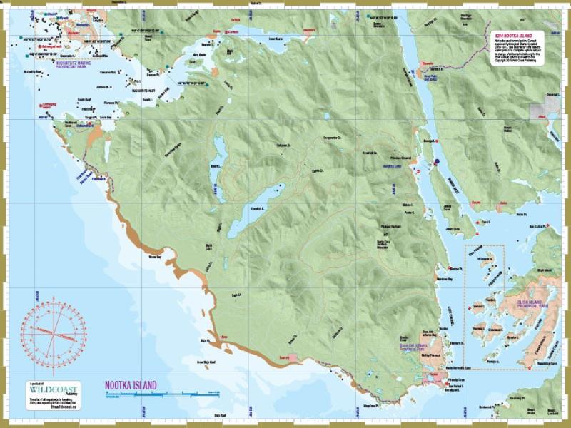
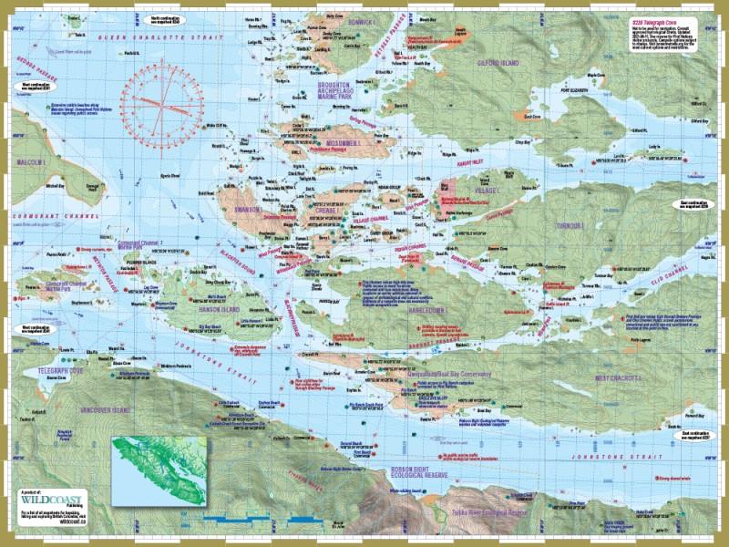
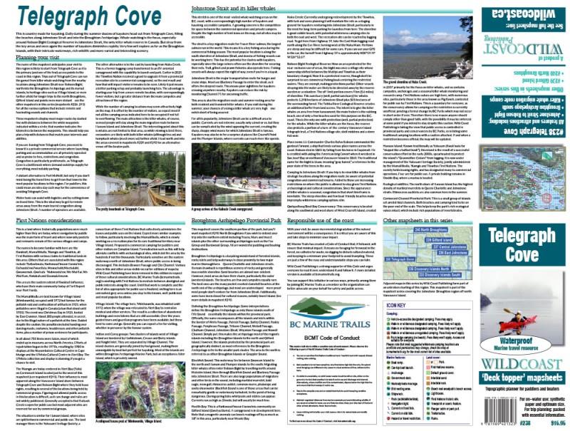
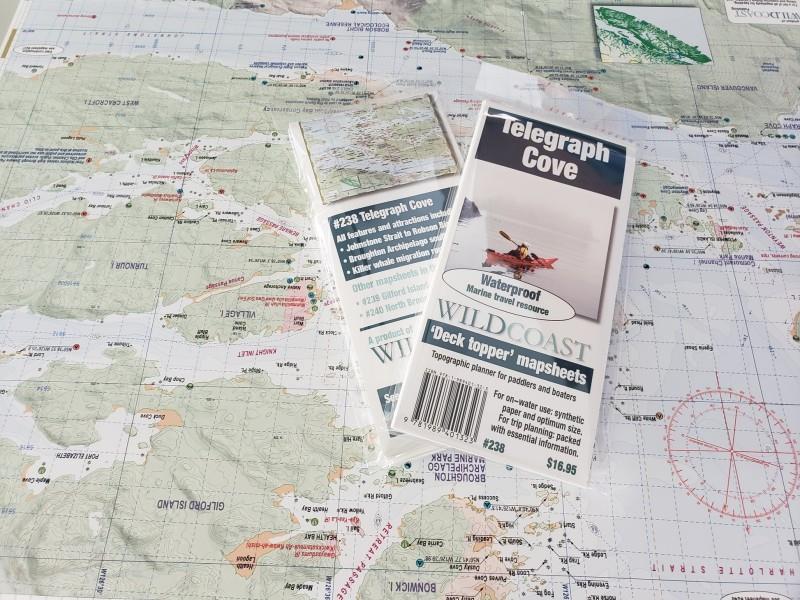
This mapsheet is intended for anyone departing from Telegraph Cove or Naka Creek into Johnstone Strait or the Broughton Archipelago. The attractions are killer whale watching near Robson Bight and heading into the picture-perfect island clusters of Broughton Archipelago Provincial Park. This mapsheet is newly updated for 2023 reflecting the latest in cultural sensitivities and other vital travel information.
Depth soundings are not included. This Deck Topper series is intended to augment marine travel and not to be used for technical motorized vessel navigation or to replace approved Hydrographic Services charts. Kayakers, canoeists and other self-propelled craft that do not require depth soundings for transit will find it sufficient for travel without other resources.
Depth soundings are not included. This Deck Topper series is intended to augment marine travel and not to be used for technical motorized vessel navigation or to replace approved Hydrographic Services charts. Kayakers, canoeists and other self-propelled craft that do not require depth soundings for transit will find it sufficient for travel without other resources.
Details & Craftsmanship
Every detail has been carefully considered to bring you the perfect product.
Details & Craftsmanship
Every detail has been carefully considered to bring you the perfect product.
Details & Craftsmanship
Every detail has been carefully considered to bring you the perfect product.
Description
This mapsheet is intended for anyone departing from Telegraph Cove or Naka Creek into Johnstone Strait or the Broughton Archipelago. The attractions are killer whale watching near Robson Bight and heading into the picture-perfect island clusters of Broughton Archipelago Provincial Park. This mapsheet is newly updated for 2023 reflecting the latest in cultural sensitivities and other vital travel information.
Depth soundings are not included. This Deck Topper series is intended to augment marine travel and not to be used for technical motorized vessel navigation or to replace approved Hydrographic Services charts. Kayakers, canoeists and other self-propelled craft that do not require depth soundings for transit will find it sufficient for travel without other resources.
Depth soundings are not included. This Deck Topper series is intended to augment marine travel and not to be used for technical motorized vessel navigation or to replace approved Hydrographic Services charts. Kayakers, canoeists and other self-propelled craft that do not require depth soundings for transit will find it sufficient for travel without other resources.