$4.14
Original: $13.81
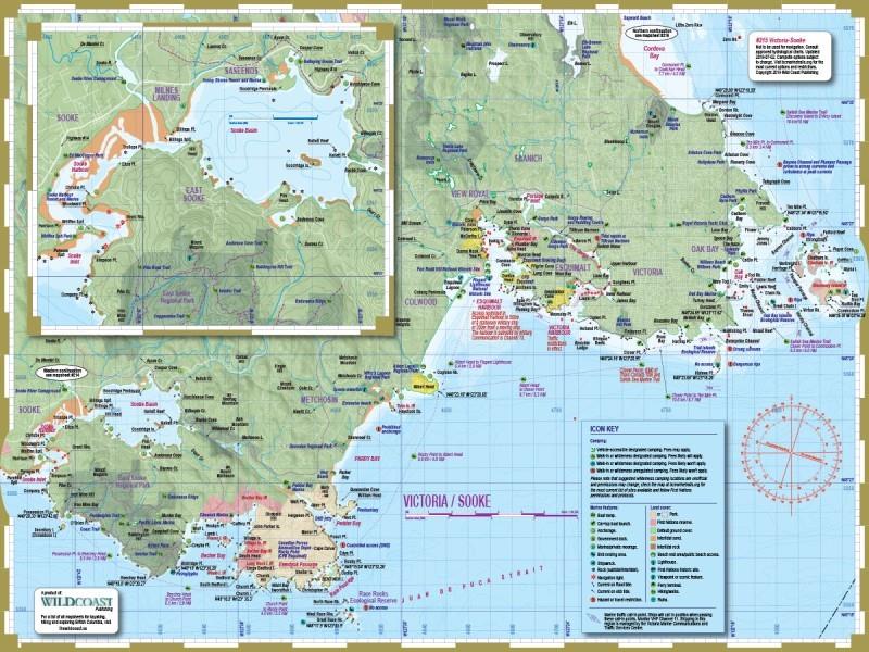
-70%#215 Victoria / Sooke Map—
$13.81
$4.14The Story
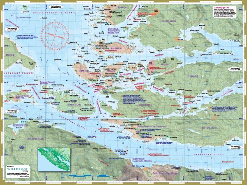
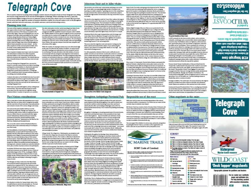
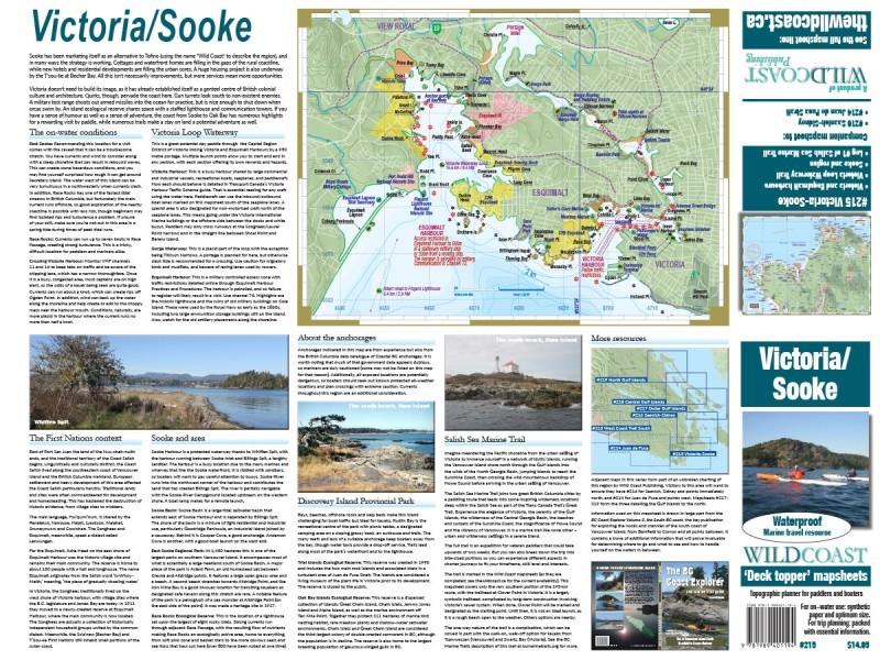
This mapsheet covers the from Sooke to Cordova Bay north of Victoria, and includes details of Sooke Basin, Esquimalt Harbour and Victoria Harbour. Covered are the first leg of the Salish Sea Marine Trail and the Victoria Waterway Loop Trail.
Depth soundings are not included. This Deck Topper series is intended to augment marine travel and not to be used for technical motorized vessel navigation or to replace approved Hydrographic Services charts. Kayakers, canoeists and other self-propelled craft that do not require depth soundings for transit will find it sufficient for travel without other resources. Mariners with electronic navigation will find it useful for visual orientation, planning and logistics.
Depth soundings are not included. This Deck Topper series is intended to augment marine travel and not to be used for technical motorized vessel navigation or to replace approved Hydrographic Services charts. Kayakers, canoeists and other self-propelled craft that do not require depth soundings for transit will find it sufficient for travel without other resources. Mariners with electronic navigation will find it useful for visual orientation, planning and logistics.
Details & Craftsmanship
Every detail has been carefully considered to bring you the perfect product.
Details & Craftsmanship
Every detail has been carefully considered to bring you the perfect product.
Description
This mapsheet covers the from Sooke to Cordova Bay north of Victoria, and includes details of Sooke Basin, Esquimalt Harbour and Victoria Harbour. Covered are the first leg of the Salish Sea Marine Trail and the Victoria Waterway Loop Trail.
Depth soundings are not included. This Deck Topper series is intended to augment marine travel and not to be used for technical motorized vessel navigation or to replace approved Hydrographic Services charts. Kayakers, canoeists and other self-propelled craft that do not require depth soundings for transit will find it sufficient for travel without other resources. Mariners with electronic navigation will find it useful for visual orientation, planning and logistics.
Depth soundings are not included. This Deck Topper series is intended to augment marine travel and not to be used for technical motorized vessel navigation or to replace approved Hydrographic Services charts. Kayakers, canoeists and other self-propelled craft that do not require depth soundings for transit will find it sufficient for travel without other resources. Mariners with electronic navigation will find it useful for visual orientation, planning and logistics.