$7.21
Original: $24.02
-70%Wilderness Navigation 4th Edition—
$24.02
$7.21The Story
Whether you’re a hiker, backpacker, kayaker, climber, or backcountry skier, this step-by-step handbook will help you find your way
Over 150 thousand copies sold
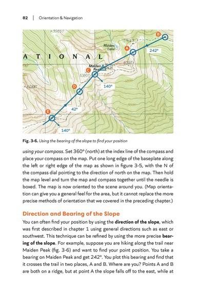
Full-color maps to highlight real-life orientation methods and challenges
Detailed descriptions and comparison charts of recommended tools, including personal locator beacons and satellite communicators
Navigation exercises and practice problems
Guidance for adapting skills and techniques for a wide range of outdoor activities
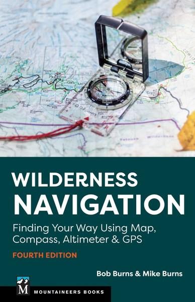
For nearly three decades, Wilderness Navigation has been the official textbook for outdoor education courses throughout the US as well as a trusted resource for adventurers all over the world. Authors and educators Bob Burns and Mike Burns describe essential tools and proven techniques for selecting and interpreting maps, taking and following compass bearings in the field, using an altimeter, and navigating with GPS using an app or dedicated device.
Over 150 thousand copies sold
Full-color maps to highlight real-life orientation methods and challenges
Detailed descriptions and comparison charts of recommended tools, including personal locator beacons and satellite communicators
Navigation exercises and practice problems
Guidance for adapting skills and techniques for a wide range of outdoor activities
For nearly three decades, Wilderness Navigation has been the official textbook for outdoor education courses throughout the US as well as a trusted resource for adventurers all over the world. Authors and educators Bob Burns and Mike Burns describe essential tools and proven techniques for selecting and interpreting maps, taking and following compass bearings in the field, using an altimeter, and navigating with GPS using an app or dedicated device.
Details & Craftsmanship
Every detail has been carefully considered to bring you the perfect product.
Details & Craftsmanship
Every detail has been carefully considered to bring you the perfect product.
Details & Craftsmanship
Every detail has been carefully considered to bring you the perfect product.
Details & Craftsmanship
Every detail has been carefully considered to bring you the perfect product.
Details & Craftsmanship
Every detail has been carefully considered to bring you the perfect product.
Description
Whether you’re a hiker, backpacker, kayaker, climber, or backcountry skier, this step-by-step handbook will help you find your way
Over 150 thousand copies sold
Full-color maps to highlight real-life orientation methods and challenges
Detailed descriptions and comparison charts of recommended tools, including personal locator beacons and satellite communicators
Navigation exercises and practice problems
Guidance for adapting skills and techniques for a wide range of outdoor activities
For nearly three decades, Wilderness Navigation has been the official textbook for outdoor education courses throughout the US as well as a trusted resource for adventurers all over the world. Authors and educators Bob Burns and Mike Burns describe essential tools and proven techniques for selecting and interpreting maps, taking and following compass bearings in the field, using an altimeter, and navigating with GPS using an app or dedicated device.